

Welcome to Bar
Welcome to the modern town with wide boulevards, surrounded by Mediterranean vegetation, the largest touristic and nautical centre at the entrance to the Adriatic Sea. Numerous cultural and historical monuments, the most important of which is the Old Town of Bar, situated 4 km away from the coast, are witnessing the turbulent history of the town. Today, its postcard consists of tourist facilities, restaurants, shops, sports fields and a marina with 1,150 berths.
Two equally beautiful shores of the municipality of Bar - the Adriatic Sea, which is 46 km long with 9 km of beaches, and Skadar Lake which is 65 km long, are ready to satisfy the diverse tastes of tourists. The names given to the beaches by the very tourists speak of their attractiveness and beauty: Pearl Coast, Golden Coast, Queen’s Beach, Red Beach, etc.
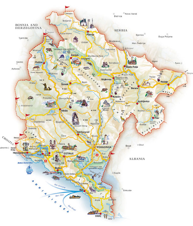
Geographical position
The area of Bar is located in the south-eastern part of Montenegro, between the Adriatic Sea and Skadar Lake.
The municipality of Bar covers an area of 505 km2, with 470 km2 of land area. Bar has more than 46 kilometres of seashore, with about twenty beaches which are approximately nine kilometres long. It also includes 128km2 of Skadar Lake area and 65km of the lake’s shore.
Coastal area
consists of the town of Bar, which is also the centre of the local government, Marina, Port, as well as Barsko, Mrkovsko and Goransko fields and small coastal towns from Čanj to Dobra Voda and Utjeha.
Lake area
refers to Skadar Lake with Virpazar and villages along the coast, Crmničko field and the Krajina region by the lake, all the way to Ostros.
Mountain area
consists of mountain ranges and peaks: Rumija 1594m, Lisinj 1353m, Sutorman 1185m, Vrsuta 1183m, Sozina 1185m and Velja Trojica 1132m.
Bar
Population
There are more than 42,000 inhabitants who live in the municipality of Bar, which makes about 7% of the overall Montenegrin population.
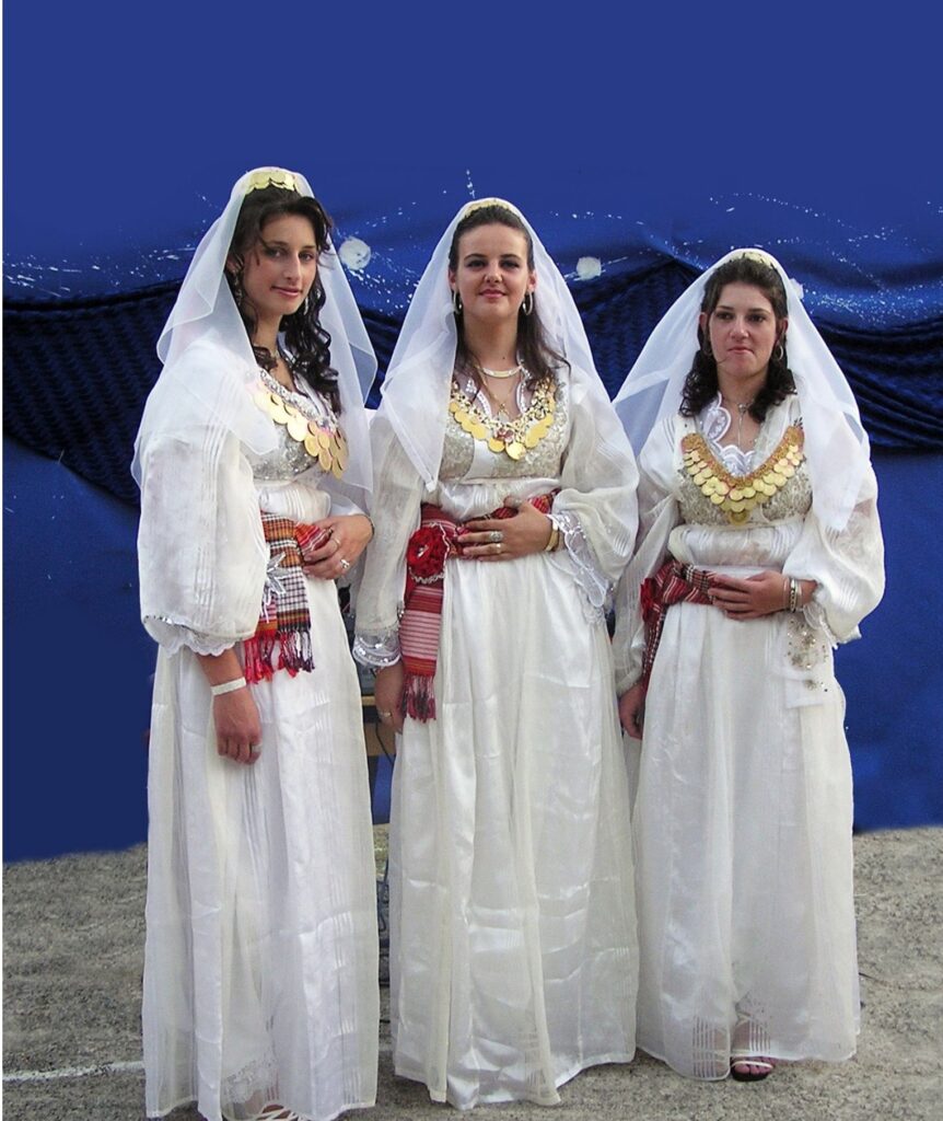
The population of Bar is mainly concentrated in highly urbanized settlements. The villages are also easily accessible by traffic, because a large number of them are located in the cultivated coastal-lake area. This location is known for its multinational and multi-confessional structure of the population, with interpersonal relations which are characterized by high degree of tolerance. The good tradition of coexistence in this area which is atypical for the Balkans, has never been disturbed by numerous state and political upheavals throughout history.
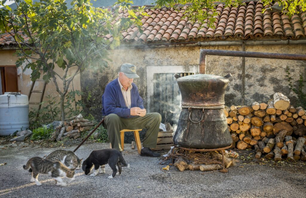
An interesting fact about the population of this area is that the micro-locations are significantly different, which is especially manifested through diverse folklore features. For instance, the area of Bar has a multitude of traditional costumes that can hardly be found in other parts of Montenegro. Perhaps the definition “harmony achieved through diversity” could be used as the simplest way to denote the population of the municipality of Bar.
Throughout history, Bar used to be a home of many notable inhabitants. In addition, a number of famous and educated people were part of various types of town administrations. They include: judges, chancellors, deputies, envoys, captains, dukes, knights, princes and others.


Climate
Bar is one of the sunniest places in southern Europe
The climate of Bar is determined by its geographical position in the temperate climate zone and the proximity of two large bodies of water – the Adriatic Sea and Skadar Lake, as well as the stretching direction of the central mountain range with Rumija massif, ranging from 800 to 1,594 meters above sea level.
One of the municipality of Bar’s features are long, hot and dry summers, and mild and rainy winters. The average annual temperature ranges from 8.7°C to 23.3°C. The maximum average temperature in July is 27.8°C, while the minimum average temperature in January is 4.3°C. The swimming season lasts from mid-May to mid-October, when the water temperature reaches up to 27°C. The average annual rainfall in this area varies from 33mm to 171mm. The highest amount of precipitation is in November and February, and the lowest in July and August.
The average sea temperature in July is 23.2ºC, and the water transparency is five meters.
Bar is well-known for a high number of sunny days, with frequent winds and a very long duration of insolation (about seven hours a day). On average, it has 2,555 hours of sunshine a year.


Traffic
The geographical position of Bar conditioned the development of all types of traffic. This area is connected with neighbouring municipalities and beyond by road, rail, sea, and indirectly by air traffic.
Road traffic
Maritime traffic
There are three significant highways passing through the municipality of Bar: Ulcinj – Bar – Budva and Bar – Petrovac – Virpazar – Podgorica, as well as the highway of great importance for the municipality of Bar and wider: Bar – Sutomore – Virpazar – Podgorica, which passes through the tunnels Sozina (4,189 metres long) and Raš (650 metres long). The regional road Virpazar – Ostros, local roads Virpazar – Komarno and Virpazar – Gluhi Do, as well as the regional road R-16 Pečurice – Kovačevići and Ckla on the border with Albania are particularly relevant for the tourism. Well-organized local traffic transports passengers between individual tourist sites, and the number of lines and means of transport increases during the tourist season.
Based on its position, the municipality of Bar is a Mediterranean and Balkan port, making the main traffic route in the country the link between Adriatic ports and the Balkan interior in the hinterland. Montenegro is also connected to the world by sea. There is only 180km of air distance from Bar to Strait of Otranto. International maritime traffic takes place through the largest port in Montenegro, the Port of Bar, which is an extremely important traffic centre and the largest company in the field of traffic. Ferries run regularly between Montenegro and Italy, on the lines Bar – Bari – Bar. Marina Bar located in the town centre, with a capacity of 900 berths at sea and 250 on land, is surrounded by the town beach, promenade, restaurants, sports fields, banks and a passenger terminal.
Railway traffic
Air traffic
The railway network in the area of the municipality of Bar consists of the Bar – Belgrade railway in the southeast-northwest direction, as well as the Bar – Nikšić railway. Rail traffic enables transport to Belgrade and further to all European destinations, as well as local transport to Podgorica, Bijelo Polje and Nikšić.
There is no airport in the municipality of Bar, but it is naturally oriented and connected with the airports in Podgorica and Tivat, the distance being 41km and 55km, respectively. Airports of Montenegro are successfully cooperating with the surrounding airports and other international airports, which significantly improves the tourist offer of Bar.